2010 07-16 orcca minicharrette - copy
•Download as PPT, PDF•
0 likes•1 view

This is a smaller, low res version of the PowerPoint presentation created for the ORCCA mini-ecocharrette meeting on Jul 15, 2010.

Recommended
More Related Content
What's hot
What's hot (19)
Similar to 2010 07-16 orcca minicharrette - copy
Similar to 2010 07-16 orcca minicharrette - copy (20)
More from Maria Cahill
More from Maria Cahill (13)
2010 07-16 orcca minicharrette - copy
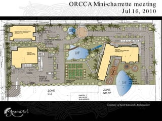
- 1. ORCCA Mini-charrette meeting Jul 16, 2010 Courtesy of Scott Edwards Architecture
- 2. The Water Balance Model: typical for Cascadia Water Quantity Before 16.5” interflow (infiltration) 26” evapo- transpiration 0.2” runoff 65” rainfall yearly avg 22” groundwater (infiltration)
- 3. The Water Balance Model Water Quantity After 0” baseflow (infiltration) reduced evapo- transpiration 63” runoff 65” rainfall yearly avg 2” evapo- transpiration Reduced infiltration
- 4. Impervious Surfaces A Watershed Perspective
- 5. The Water Balance Model Water Quality Before Some sediment
- 6. The Water Balance Model Water Quality After Sediment (air particulates), dissolved pollutants (nitrogen, zinc), heavy metals, Feces, Temperature, other debris Sediment/turbidity, Hydrocarbons, Heavy metals, temp, feces, other chemicals Sediment/turbidity fertilizers, pesticides herbicides, feces, heavy metals
- 7. Air
- 8. Soil Image from Soil Quality Information Sheet , U.S. Department of Agriculture
- 9. B est M anagement P ractice s (aka BMPs) Two Types N
- 13. Infiltration trenches are a UIC not recommended for our timeline
- 14. Rain Gardens
- 15. Other vegetated systems: Planters
- 16. Other vegetated systems: Vegetated Filter Strips
- 17. Pervious pavements: Use with CAUTION here POROUS ASPHALT IN 1- 2” LIFT UNCOMPACTED SUBGRADE NON-WOVEN PROPYLENE GEOTEXTILE 12” 1-1/2” to 1” WASHED CRUSHED AGGREGATE 3”
- 19. Eco-roofs
- 20. Cisterns for parking lot, street, sidewalk, and roof storage
- 22. Trellises & other vertical vegetation
- 23. Trellises & other vertical vegetation
- 24. Limit Disturbance in Planning
- 25. Limit Disturbance in Design Save a Tree
- 26. Limit Disturbance Construction Practices
- 27. Limit Disturbance Construction Practices: Don’t cement treat the soil
- 30. Storage in wetland at Oleson Woods Apts
- 32. Compost Amendment & other soil restoration practices Photos on left are from Soils for Salmon website
- 34. Eliminate curb & gutter
- 35. Eliminate curb & gutter
- 37. Swale & Daylighting Details
- 38. Swale & Daylighting Details
- 39. Check dams
- 41. Transportation BMPs Traffic calming woonerf Photo from Techniques for Urban Sustainability website
- 42. Additional BMPs: Source Control
- 43. Additional BMPs Source Control in Construction
- 44. Additional BMPs Source Control in Construction Photo excerpted from “BMPs for Stormwater Discharges Associated with Construction Activities”, DEQ, Feb 2006
- 45. Additional BMPs Source Control in Construction Photos and study and text excerpted from “BMPs for Stormwater Discharges Associated with Construction Activities”, DEQ, Feb 2006
- 46. Additional BMPs Source Control Post Construction
- 47. Biodiversity
- 50. ORCCA Mini-charrette meeting Jul 16, 2010 Sustainability for all the places between the buildings.